×
Aircraft / Aviation Vehicles & Artillery Small Arms Warships & Submarines Military Ranks Military Pay Scale (2024) Special Forces

USNS Henson (T-ASG-63)


Oceanographic Survey Ship


United States | 1998


"The USNS Henson was sent to map coastline and undersea obstacles off of Haiti after the devastating earthquake in January of 2010."

Power & Performance
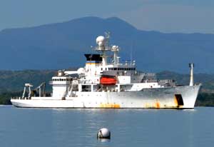
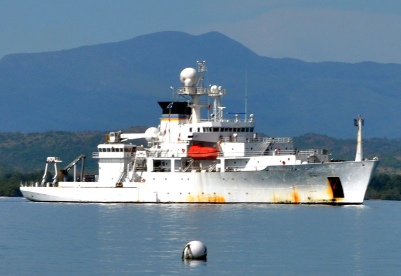
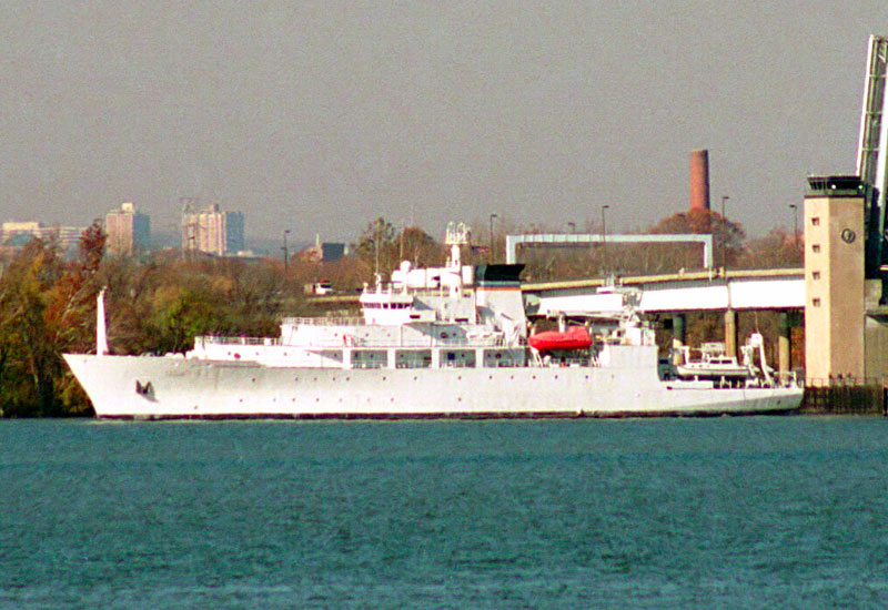
Those special qualities that separate one sea-going vessel design from another. Performance specifications presented assume optimal operating conditions for USNS Henson (T-ASG-63).
Diesel electric engines; 4 x (EMD) Baylor disel generators developing 11,425 horsepower; 2 x General Electric CDF 1944 motors generating 8,000 horsepower (6,000hp sustained); 2 x Lips Z drives: bow thruster at 1,500 horsepower.
Propulsion
16.0 kts
18.4 mph
Surface Speed
6,479 nm
7,456 miles | 11,999 km
Range
Structure
The bow-to-stern, port-to-starboard physical qualities of USNS Henson (T-ASG-63).
52
Personnel
Complement
328.5 ft
100.13 meters
O/A Length
58.0 ft
17.68 meters
Beam
19.0 ft
5.79 meters
Draught
5,000
tons
Displacement
Ships-in-Class (6)
Notable series variants as part of the USNS Henson (T-ASG-63) family line as relating to the Pathfinder-class group.
USNS Pathfinder (T-AGS-60); USNS Sumner (T-AGS-61); USNS Bowditch (T-AGS-62); USNS Henson (T-AGS-63); USNS Broce C. Heezen (T-AGS-64); Mary Sears (T-AGS-65)
Authored By: JR Potts, AUS 173d AB | Last Edited: 07/19/2017 | Content ©www.MilitaryFactory.com | The following text is exclusive to this site; No A.I. was used in the generation of this content.

The USNS Henson is an oceanographic survey ship owned by the United States Navy and is used to collect data for the purpose of geophysical, biological, physical and acoustical surveys. Because of its expansive reach, the American military needs information on all ocean environments around the world in order to support military, navigation and humanitarian missions as needed. The Henson and her sister ships in the Pathfinder-class do not have home ports due to the Military Sealift Commands mobile structure. Essentially her "Home" is where the mission is.

The Henson's purpose is to hold and transport the abundance of sophisticated scientific equipment for the twenty-seven scientists onboard who work to collect data related on their own field of study. The data collected ranges from the surface of the water, through the depths and straight into the sea floor. The ship can study the atmosphere while any coastline can be mapped. Henson gathers, archives, and transmits data collected to MSC onshore by radio or satellite communications equipment. The data collected helps the Navy to develop current and future undersea warfare plans along with surveying sea beds as well as locating lost aircraft and ships - either past or present.

Content ©MilitaryFactory.com; No Reproduction Permitted.


The ships construction is designed to support the bevy of instruments connected below the water line. The hull has a multi-beam shape to support the equipment and offers good sea keeping. The military's knowledge of the ocean environment has been dramatically increased due to oceanographic survey ships like the Henson.

Henson was named for Matthew Henson, a member of the Robert Peary 1909 expedition to the North Pole. USNS Henson herself is operated by Horizon Lines, providing the crew for the ship, though mission orders come from Military Sealift Command. When any of the Pathfinder-class are sent into waters where hostile action might transpire, the US Navy proactively sends along a protection force as escort.

A listing of some of the scientific equipment onboard is as follows:

Multi-beam Echo Sounding System ( SIMRAD EM121A) is a 121 beam bathymetric sonar system used to chart waters from 10 to 11,000 meters in real time.

Seismic System is used as a deep penetration instrument, this being a towed array mapping geological topography.

Shallow Water Echo Sounder System (ODEC BATHY-2000) provides a single beam for depths to 12,000 meters.

Sub Bottom Profiler (ODEC BATHY-2000) is capable of determining seabed structure down to 10,000 meters.

Acoustic Doppler (RD VM-0150) profiles ocean current speeds, depth and directions up to 380 meters.

Expandable Sensor Subsystem surveys other sonars for support corrections.

Sound Velocity Profiles (XSV) helps to survey sonar systems for speed thru water columns.

Magnetometer (E#GG811/613) uses magnets to map the earth's magnetic field to 7,000 meters.

Water Sampler Subsystem operates water collectors to depths of 7,000 meters.

Bottom Transponder Navigation System is a 50 kHz real time navigation system designed to help position the ship.

On January 20th, 2010, USNS Henson was sent to Haiti to study the harbors and costal waterways, mapping underwater obstructions caused by the large earthquake. To accomplish the mission she utilized the many types of sonar systems onboard.

Content ©MilitaryFactory.com; No Reproduction Permitted.
Operators
Global operator(s) of the USNS Henson (T-ASG-63). Nations are displayed by flag, each linked to their respective national naval warfare listing.
National flag of the United States

[ United States ]
1 / 2
Image of the USNS Henson (T-ASG-63)
Bow starboard side view of the USNS Henson in calm waters
2 / 2
Image of the USNS Henson (T-ASG-63)
portside view of the USNS Henson navigating a waterway after passing through a raised bridge system

Going Further...
USNS Henson (T-ASG-63) Oceanographic Survey Ship appears in the following collections:
HOME
NAVAL WARFARE INDEX
WARSHIPS BY COUNTRY
SHIPBUILDERS
COMPARE WARSHIPS
SHIPS BY CONFLICT
SHIPS BY TYPE
SHIPS BY DECADE
MODERN VESSELS
Disclaimer | Privacy Policy | Cookies

2024 Military Pay Scale Military Ranks of the World U.S. Department of Defense Dictionary Conversion Calculators Military Alphabet Code Military Map Symbols Breakdown U.S. 5-Star Generals List WWII Weapons by Country World War Next

The "Military Factory" name and MilitaryFactory.com logo are registered ® U.S. trademarks protected by all applicable domestic and international intellectual property laws. All written content, illustrations, and photography are unique to this website (unless where indicated) and not for reuse/reproduction in any form. Material presented throughout this website is for historical and entertainment value only and should not to be construed as usable for hardware restoration, maintenance, or general operation. We do not sell any of the items showcased on this site. Please direct all other inquiries to militaryfactory AT gmail.com. No A.I. was used in the generation of this content.

Part of a network of sites that includes GlobalFirepower, a data-driven property used in ranking the top military powers of the world, WDMMA.org (World Directory of Modern Military Aircraft), WDMMW.org (World Directory of Modern Military Warships), SR71blackbird.org, detailing the history of the world's most iconic spyplane, and MilitaryRibbons.info, cataloguing military medals and ribbons. Special Interest: RailRoad Junction, the locomotive encyclopedia.


©2024 www.MilitaryFactory.com • All Rights Reserved • Content ©2003-2024 (21yrs)